this post was submitted on 07 Aug 2024
42 points (100.0% liked)
Climate - truthful information about climate, related activism and politics.
5212 readers
779 users here now
Discussion of climate, how it is changing, activism around that, the politics, and the energy systems change we need in order to stabilize things.
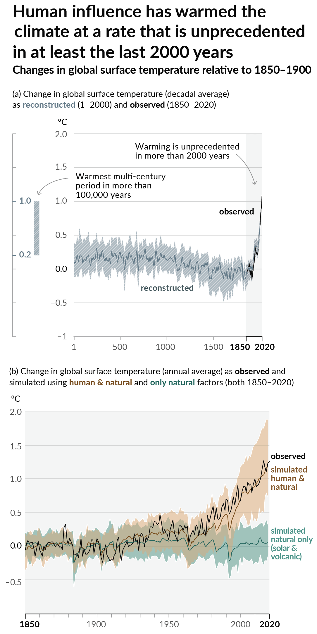
As a starting point, the burning of fossil fuels, and to a lesser extent deforestation and release of methane are responsible for the warming in recent decades:

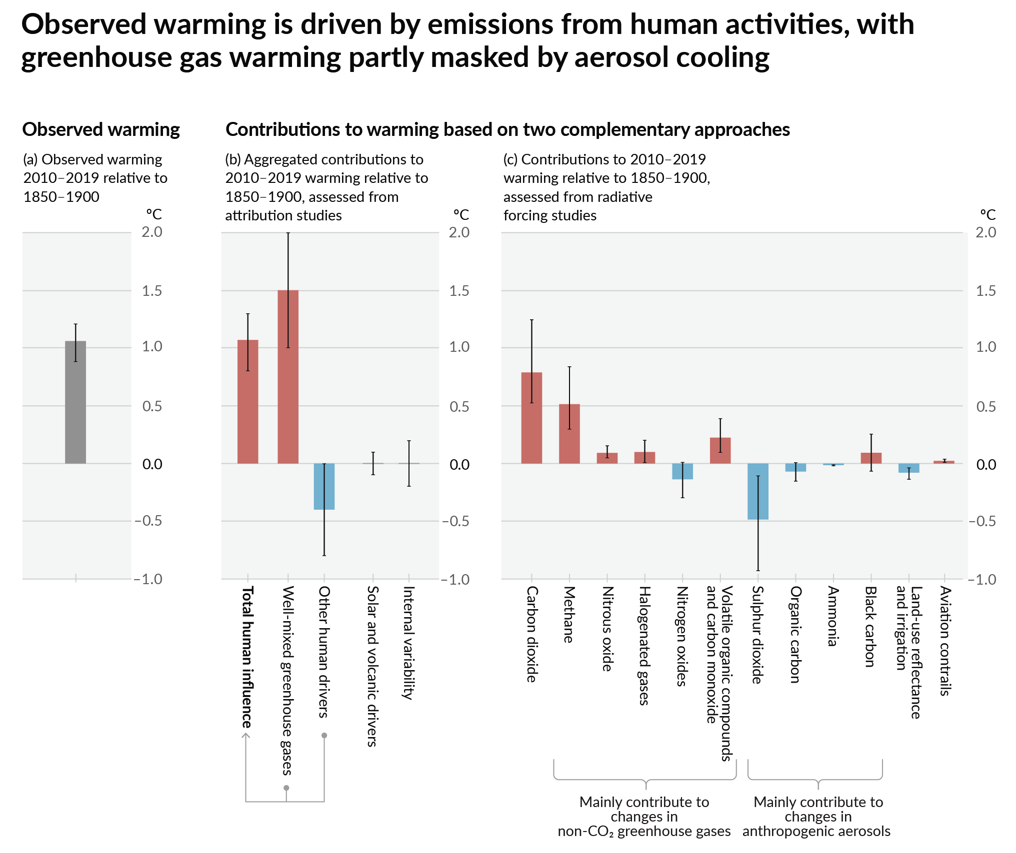
How much each change to the atmosphere has warmed the world:

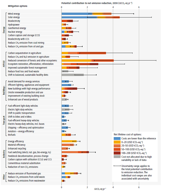
Recommended actions to cut greenhouse gas emissions in the near future:

Anti-science, inactivism, and unsupported conspiracy theories are not ok here.
founded 1 year ago
MODERATORS
you are viewing a single comment's thread
view the rest of the comments
view the rest of the comments
Unfortunately these satellites don't have a high-enough resolution for oil and gas source attribution in most cases. They're great for CAFOs and landfills, though.
My understanding is that the plan is to use a mix of high-frequency-low-resolution imaging with less-frequent-higher-resolution images to pinpoint specific leak sources.
That's true, but because oil and gas emissions are stochastic in nature, it's expensive and difficult to get enough measurements from airplanes and drones to really fill in the gaps. There are also only so many planes available that can do this kind of measurement. MethaneAir is one. The state of Colorado has funded these kinds of flights, but only for a few weeks per year and only for a small subset of the oil and gas industry in the state.
These flights also have to be planned long in advance and it's difficult to react to emissions seen from satellites. This part will hopefully improve as time goes on.